Emergency Communication Satellite Launched June 23, 2025 @ 2:19pm PST
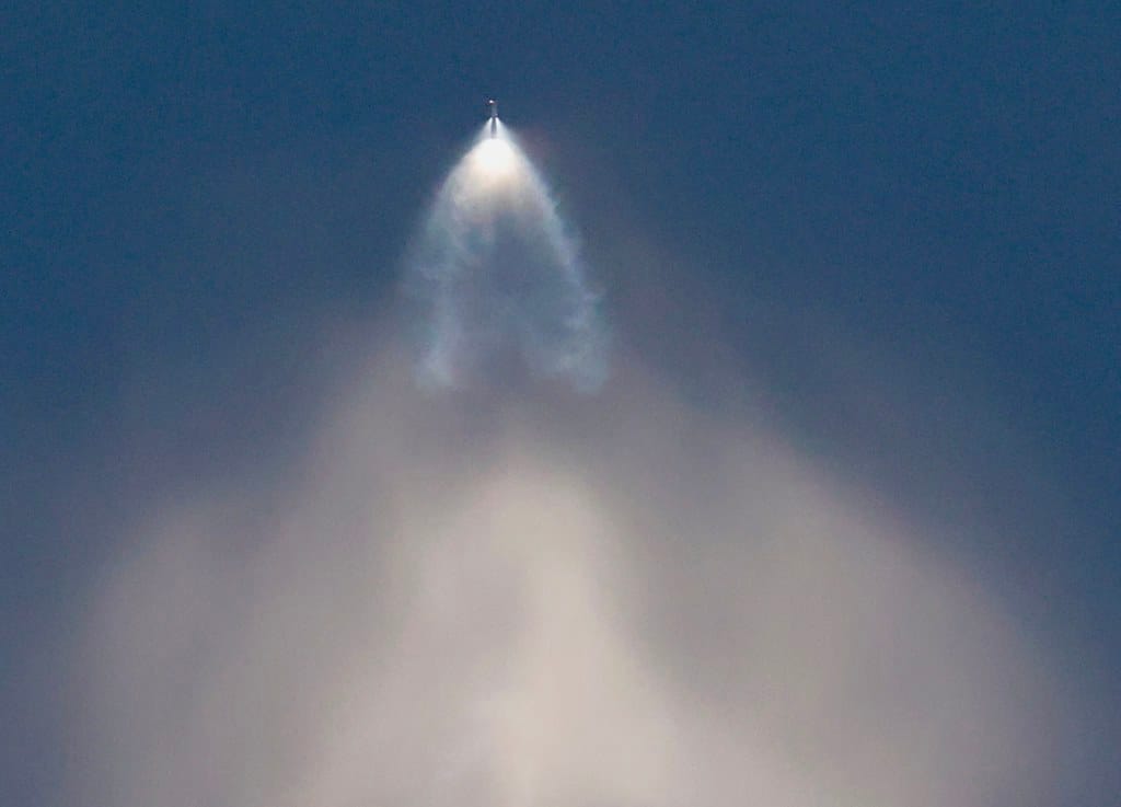
Update: The satellite successfully Launched at ~2pm Monday June 23rd from Vandenburg Space Force Base via SpaceX on Transporter 14. You can find more details and watch it live here. See also wikipedia.
Update 2: You can now track the satellite here.
Good Ancestor is proud to announce the launch of our first satellite — This milestone marks phase II completion of the project we embarked on two years ago after winning a grant for our proposal in late 2022.
This initiative is part of our AI and Critical Infrastructure project, our Victims of Conflict work, and our The Archive project. See those for further background info.
[Donor subscribers can find detailed docs via: the satellite project.]
What the satellite does
It's a test satellite. The satellite's main purpose is to broadcast news, alerts, maps, and useful information to your cell phone from space, for free, anywhere in the world. It also does other fun things like wildlife tracking.
It's designed to be as inexpensive as possible for private individuals and small governments, and built with open source software and hardware.
Why we thought this was important to do..
During humanitarian crises such as war and natural disasters, the internet and cell service often go down locally, making it difficult or impossible to send aid and evacuation instructions to the general public.
The United Nations, after identifying warning systems as one of the cheapest ways to save lives – has allocated billions of dollars to UN Early Warning System goals for poor countries facing natural disasters, and yet about half of the world still has none.
At the same time satellite hardware and launch costs have fallen significantly and Starlink and competitors have raced to build cell towers in space for paying subscribers, and cell companies have made cell phones able to receive from space. In the next few years, nearly everyone will have one.
In richer countries – humanity has not been in the information age long enough to have made good recovery plans for threats like solar flares, electro magnetic pulses from nuclear weapons, and emerging threats from AI and great power cyber war that could see novel regional or large scale infrastructure disasters.
Working with All-Fed and some satellite industry veterans and radiation physicists, we set out to investigate building hardened and inexpensive hot-standby communication systems that could send out emergency information and applications during internet disruptions to cell phones (without needing their cell service to work).
We thought this was a good idea – But how to make it a reality?
Mission plan - What's next
The satellite has a primary 90 day testing mission. After that mission is over, it will be available for research and general use.
After that is a big mission to build supporting open source software, cell phone apps, tools and experiments, and to look for commercial production partnerships and or fundraising and scaling strategies (launch more satellites or partner with existing ones) and to publish our work. We are working on a partnership to include the ability to broadcast over GPS signals to all capable GPS devices as well.
The phase end goal for the research test will be to broadcast emergency response information from All-Fed - Alliance to feed people in global disasters directly to a normal cell phone without cell service.
People interested in volunteering can sign up below or Contact us.
How we built it...
In Project phase 1 (2022), we made a written proposal and pulled together prototype funding and volunteers.
We then obtained the right to broadcast on radio spectrum to cell phones in many countries via a complex bureaucratic process (don't try this at home), and began investigating partnerships with emerging providers.
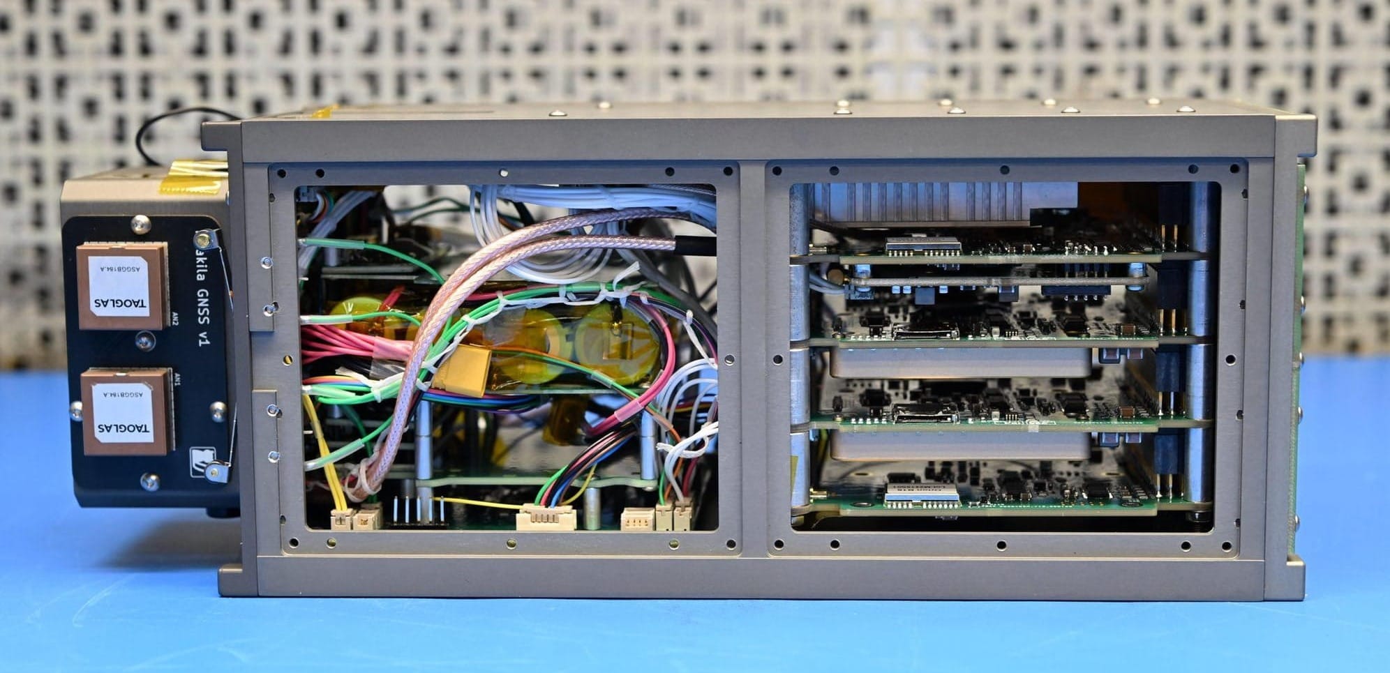
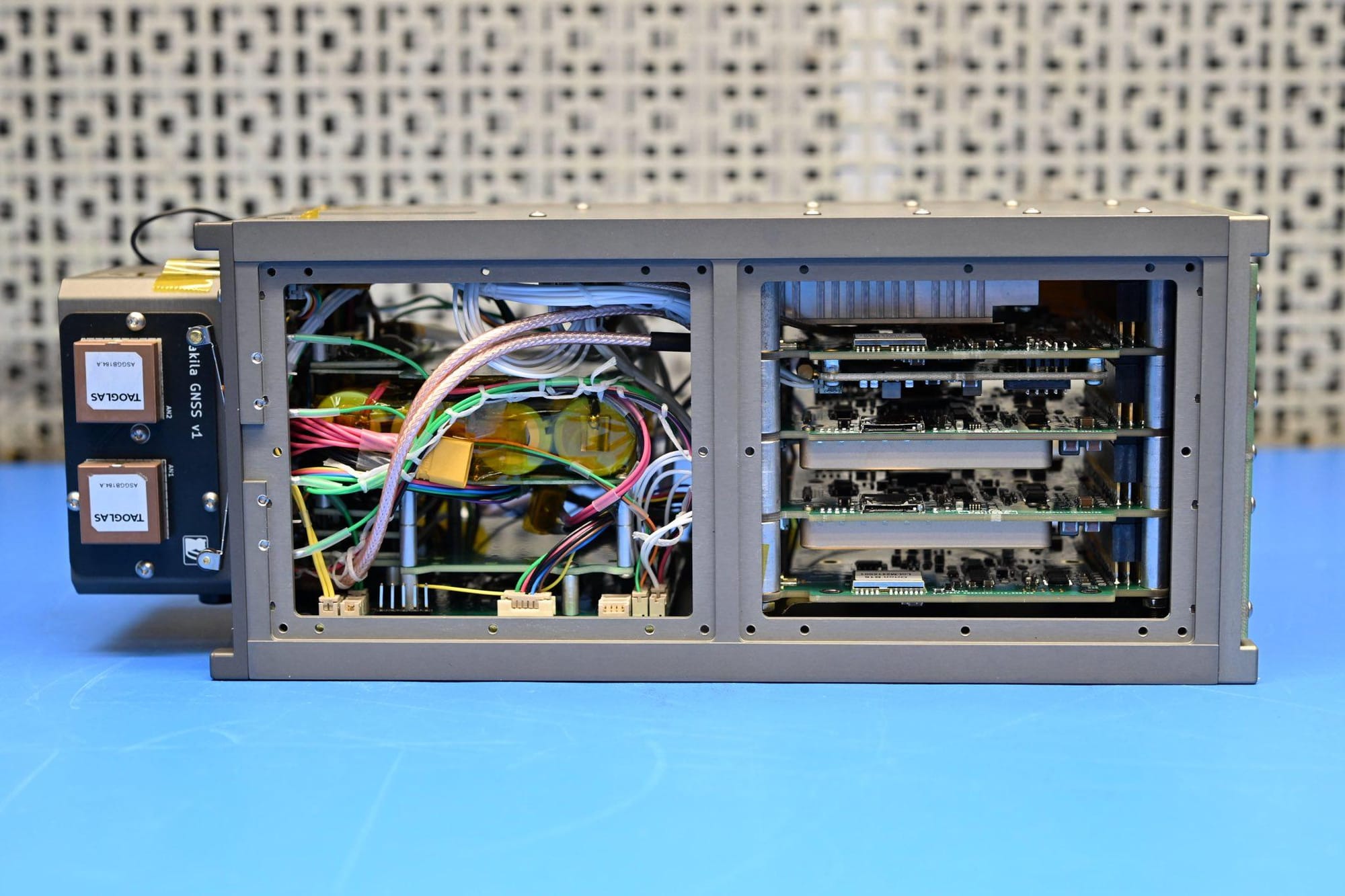
In the mean time we designed a prototype test system:
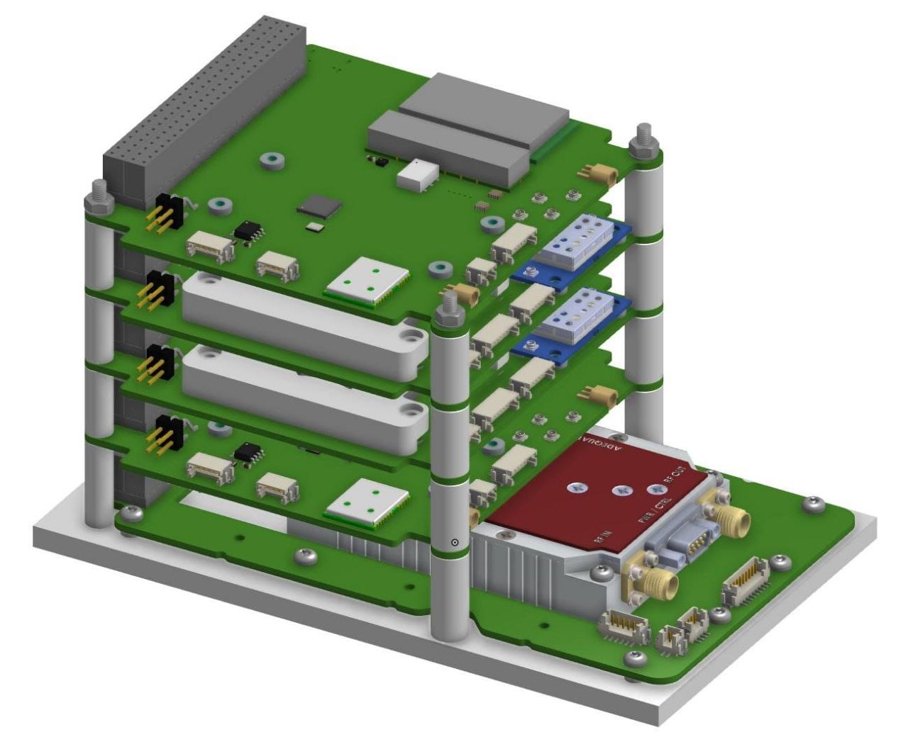
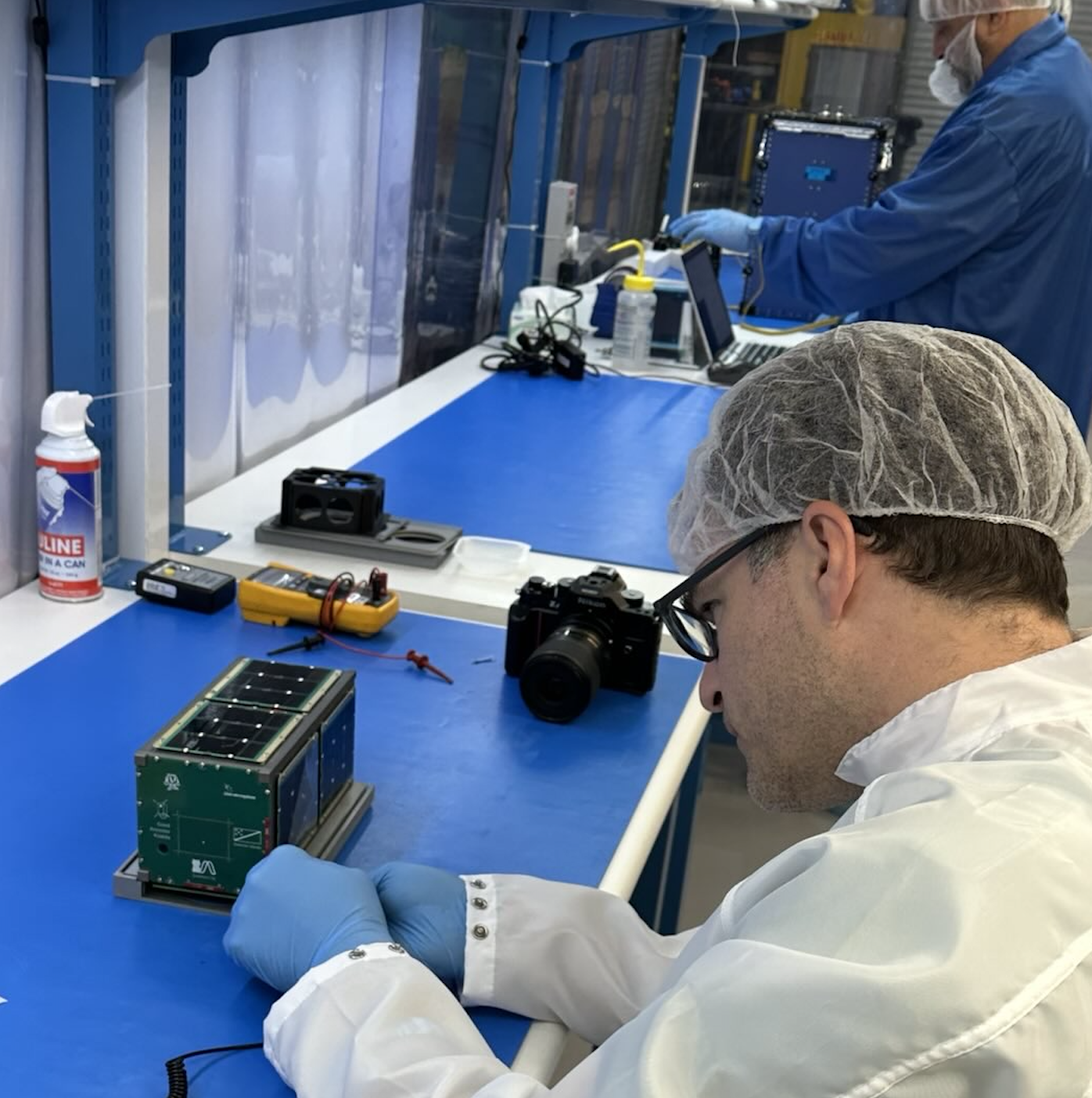
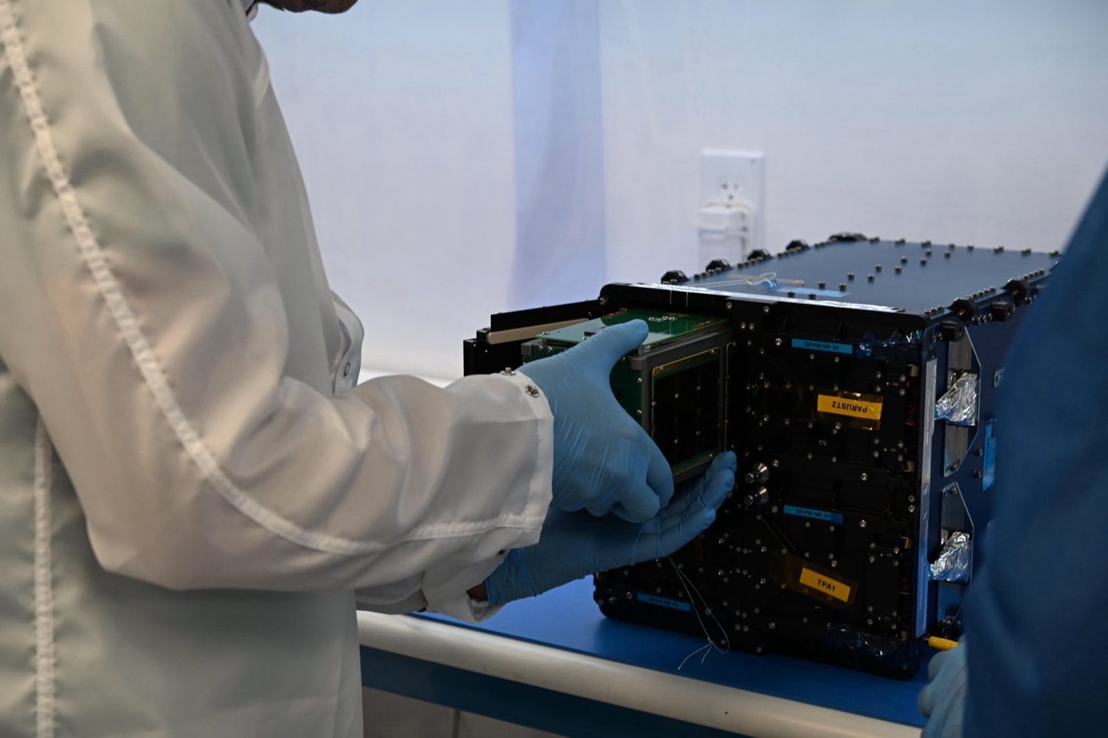
Fabricated it

And assembled it
Tested the pop out antennas (fun)
Attached the solar panels
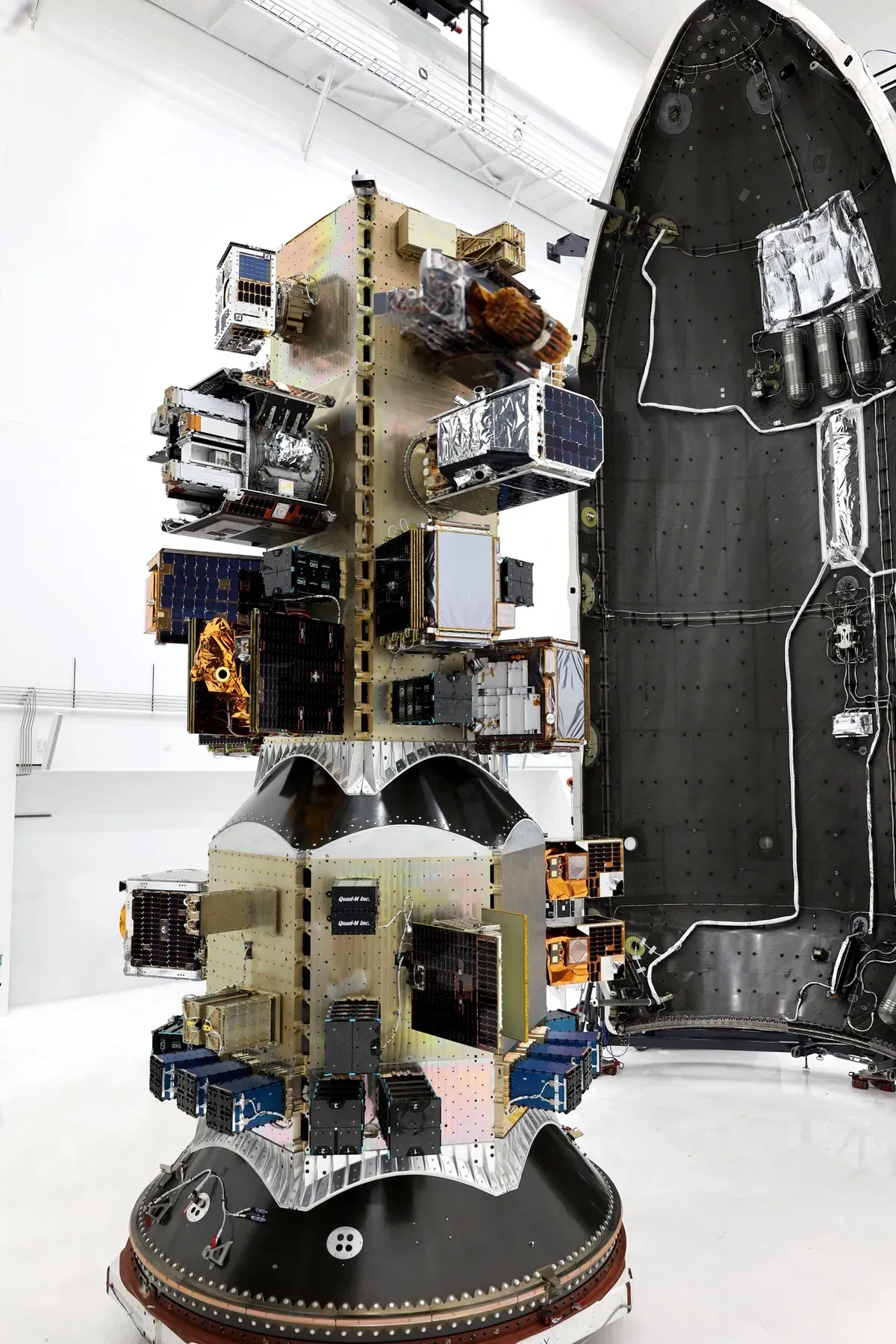
It was sent to the shaking machine in mid-March. Since nothing fell off, it was ready for integration into the deployer (the black box below)
The deployer was then bolted to the nose cone of a SpaceX Falcon rocket (the launch vehicle) in April. (Special thanks to our launch broker SEOPS)
..on or about June 20 (weather permitting), that rocket will go from Vandenburg Space Force Base into Sun Synchronous Orbit (SSO) and fling off our little test satellite into space, where it will begin its first 90 days mission.

Somewhere around October, we will let our collaborators start playing with it. (more on that soon)
What else could it do?
This satellite is capable of broadcasting emergency information directly to cell phones globally (no cell plan required) in L-band (via LTE MBMS), via LoRA, and Bluetooth Low Energy, as well as to radios on more traditional VHF/UHF channels.
There are also tests of agricultural monitoring (see Vermont Research Farm), wildlife tracking beacons (in southeast Asia), and long range low-power communication tests.
Novel Wildlife Tracking Antenna
In addition to two XTRX software defined radios, Kilakila houses a deployable—and experimental—antenna array with software defined polarization. The purpose of this antenna is to improve performance over conventional circularly polarized antennas, which are normally used in space. The problems with circular polarized antennas is that they immediately halve the radio link quality due to a mismatch against the linearly polarized UHF antennas used by wildlife tags. As the spacecraft approaches the area of interest, the experimental antenna can be arbitrarily oriented to enable greater sensitivity for reception of very low-power transmissions on earth.
Yes, it has AI, but on the ground
The design also has a distributed AI emergency dispatcher concept which uses a locally run LLM with map and weather details that can answer questions about safe exit routes and meeting points from an unattended ground station. See The Archive - Digital Sovereignty Tools for more.
.. and open source mission control
We have also prototyped open source inexpensive ground station designs (about $1-5k), which via volunteers we could deploy across several countries and regions to increase our upload capacity to the satellite.
This design also allows ground station to ground station and ground station to cell phone communication without the internet.
As part of that we have made a small grant to MakeShift to provide students and makers the equipment (located on top of Turbine Flats innovation community) to help test and monitor the satellite, and display it to young people at their Maker Fair using SatNOGS, TinyGS and other tools.
If you'd like to keep posted on this project, be sure to sign up for our newsletter – which we use sparingly, and we will share more opportunities for how to get involved, or Contact us directly. Donations are appreciated as well.
Related
We also participated in grantee AI Objective Institute's Supply Chain Observatory and it's extreme weather hackathon.
This initiative is part of our AI and Critical Infrastructure project, our Victims of Conflict work, and our related repository project The Archive.
Read in detail about the satellite project (Donors only link).